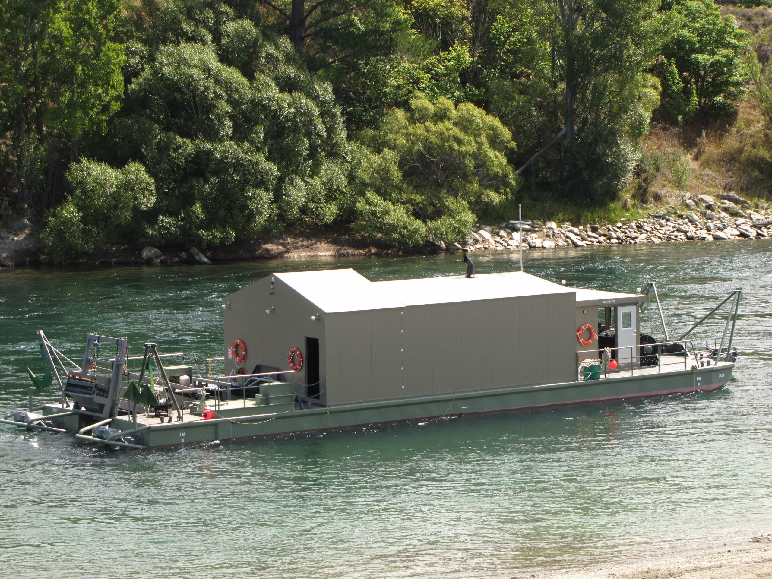
Gold will be dredged from the Upper Clutha River whether a resource consent is granted or not, because the mining company has a ‘‘plan B’’, its lawyer says.
Cold Gold Clutha Ltd (CGC) is seeking resource consent to suction-mine for gold on the Upper Clutha River, from the Luggate Bridge to the confluence of the Clutha and Lindis Rivers — about 23km.
The company wants to use a suction dredge that is a selfpowered steel pontoon catamaran 23.9m long with a beam of 6.6m.
Consents are required from the Otago Regional Council, the Central Otago District Council and the Queenstown Lakes District Council.
Both ORC consultant planner Josie Burrows and CODC and QLDC consultant planner Kirstyn Royce recommended the application be declined.
Commissioners Craig Welsh, of Nelson, chairman Rob van Voorthuysen, of Napier, and Jane Sinclair, of Queenstown, heard evidence in Cromwell in November.
The hearing was adjourned while questions from the commissioners were answered.
In her closing submission, Cold Gold Clutha lawyer Bridget Irving said the company held the mining permit for the proposed dredging area.
While it was an exclusive right, it could allow third parties to dredge in the area and had already done so themselves to establish the viability of the larger dredge area.
‘‘Permitted dredging activity is Cold Gold’s ‘plan B’ in the event the consent is declined,’’ Ms Irving said.
Dredging is permitted in the Otago Regional Council’s water plan if it meets a range of criteria, including the size of the suction nozzle and leaving no conspicuous colour or clarity change in the water any more than 100m from the activity.
Ms Irving said CGC would establish a small fleet of permitted dredges to recoup the cost of obtaining the mining permit.
While those dredges would have to operate within the permitted activity rules, their design meant they would have to operate in shallower, more ecologically sensitive areas of the river than the proposed dredge would.
The smaller dredges would not be subject to the conditions the applicants had proposed for the large vessel operation, she said.
Responding to the commissioners’ questions about other river-users’ safety around the dredge, Queenstown Lakes District Council harbourmaster said an anchoring animation shown at the hearing differed from the original application, which showed anchors directly in front of the dredge and not protruding into the river flow.
Their concern was about other river users being able to safely navigate around the dredge.
Mooring lines extending from the dredge to opposing river banks would create a significant navigational hazard unless they were significantly above or below the water surface.
In their experience, prominent signage, or even closing the river, did not stop people going into an area, whether they were unaware of or chose to ignore the closure and potential danger, the harbourmaster said.
The commissioners are yet to make a decision.


